Top 7 Hikes in the Lofoten Islands, Norway
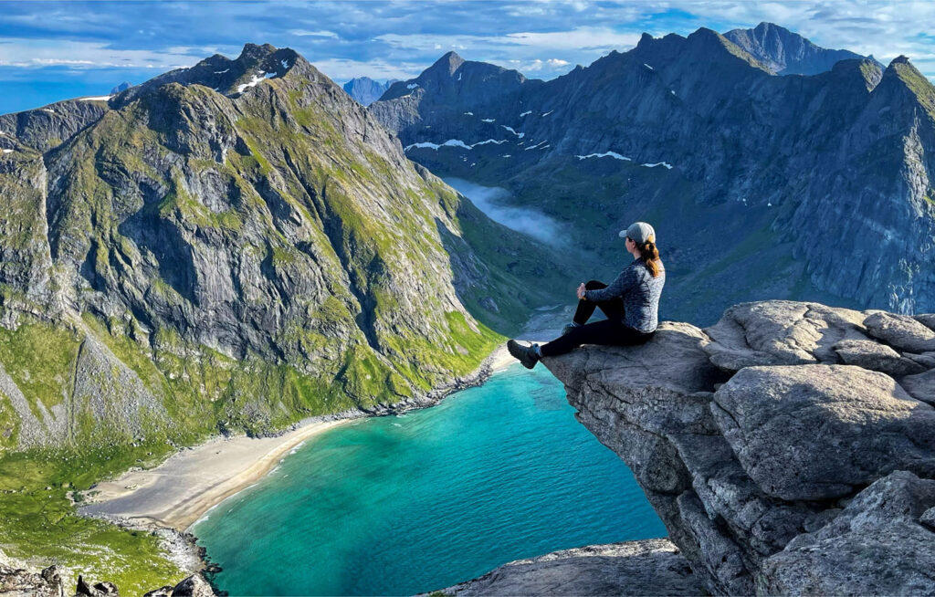
Many outdoor enthusiasts and mountaineers flock to the Lofoten Islands in Norway for some of the world’s most spectacular hikes. Norway, in general, is a hiker’s paradise, but the Lofoten Islands are considered to be the crown jewel of this beautiful country.
Located in the Arctic Circle, Lofoten offers jagged peaks, lush green valleys, white sand beaches with turquoise waters, widespread camper van culture and endless opportunities to be outdoors. What’s not to love; Lofoten truly has it all.
While there are plenty of other things to do whether you are visiting for a few days or a few weeks, this post will specifically focus on the best, and my personal favorite, hiking trails in Lofoten. For other interesting things to do in the Lofoten Islands, if you are not necessarily an avid hiker, read this post.
When is the best time to hike in Lofoten?
The best time to hike in Lofoten is during summer months. From March until late July and even August the days are longer, and the temperatures are warmer making it an ideal time to hike.
The Midnight Sun that starts from late May and lasts until end of July offers endless possibilities to stay outdoors. The phenomenon of the never-setting sun occurs every year and lasts for about two months. The temperature during this time is about 60F, which makes it ideal for hiking.
Best Hikes in the Lofoten Islands
Here are some of the best hikes, along with their elevation, distance, and estimated time to complete:
1. Reinebringen
- Elevation: 448 meters (1,470 ft)
- Distance: 1.4 miles (2.2 km) round trip / 1978 steps
- Time: 2-3 hours
- Difficulty: Moderate
- Starting Point: The trailhead is conveniently located just outside the charming fishing village of Reine
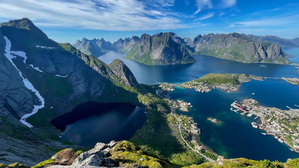
Reinebringen is arguably the most famous hike in Lofoten. One of the locals told me that New York times once named it as one of the top 10 mountains one must conquer in their lifetime. And rightfully so.
It might seem like a walk in a park given it’s only 1.4 miles round trip, but don’t let that fool you. The sheer number of steps (1978!) is a daunting task, but these steps actually make the hike easier and safer.
Nepalese sherpas put these steps to protect the ground from erosion. It took them almost 5 years to complete this work (2016-2021)! As you start climbing these steps, especially on a hot sunny afternoon, you’ll appreciate the utter level of their endurance.
Once you reach the top of the mountain, you’ll understand why this peak is considered one of the most beautiful peaks in the world. From the top, you’ll be able to see the quintessential fishing village of Reine, deep blue waters of the neighboring fjords and gorgeous mountains surrounding the area. The sight is truly one to behold.
2. Horseid Beach
- Elevation: 453 meters (1,486 ft)
- Distance: 6 miles (9 km) round trip
- Time: 6 hours
- Difficulty: Easy
- Starting Point: Take the ferry from Reine and exit at Kierkefjord. Walk to the right through the village past a stream and you’ll see a sign on the left for the beginning of the trail.
Because of its remote location, the Horseid Beach sees far fewer visitors than the Kvalvika Beach and the Bunes Beach, which makes this destination even more special. This is a perfect place if you want to spend a few days camping in a remote isolated place.
If you choose not to stay overnight, plan to dedicate a whole day for this adventure. The hike to the beach takes about 2 hours once you get off the ferry and is relatively easy. You will be passing through valleys and flower meadows and at the end you’ll be rewarded with a panoramic view of the expansive Horseid Beach.
Spend a few hours basking in the sun or swimming in the refreshing Arctic waters before heading back to your evening ferry. If you choose to spend a few days camping surrounded by the unspoiled beauty of this place, make sure to bring all your supplies with you, as the last place to get food and other necessities is in Reine. If the weather is bad, there are some sheltered spots hidden between the dunes.
3. Ryten & Kvalvika Beach
- Elevation: 543 meters (1,781 ft)
- Distance: 5.4 miles (8.7 km)
- Time: 4-5 hours
- Difficulty: Moderate
- Starting Point: The trail to Ryten starts at the Innersand parking lot (if the parking lot is full, you can continue down the road and park at the next spot for free)
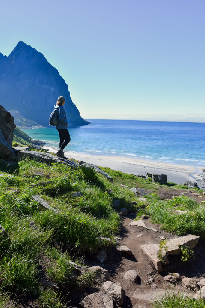
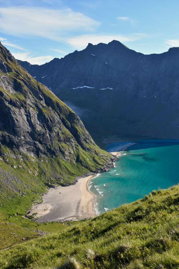
This hike combines a mountain ascent with a visit to the beautiful Kvalvika Beach. You start the hike at the Innersand parking lot and hike for about 1.9 miles (3 km) to Kvalvika Beach. It’s an easy hike first going up and then down a hill. The beach itself is gorgeous with rock formation on both sides that help you escape the northern winds. You can spend a few hours on the beach basking in the warm rays of the Midnight Sun.
Once you spend the afternoon on the beach, you can start making your way up through the beautiful flower-filled fields up to the Ryten summit. The hike to the summit is about 2.2 miles (3.5 km) one way. The views from the summit are truly breathtaking. This was my favorite summit of all my hikes in Lofoten. The clouds covering nearby mountains, the deep blue waters and the pristine white sands of Kvalvika Beach were simply unmatched.
From the summit you can get back the same way if your car is parked at the Innersand parking lot or if you are not dependent on your car, you can hike back to the village of Kvalvika. This is the route I chose and once I reached the village, I hitched a ride from a local back to my van.
To the left of Kvalvika beach is another small beach. To make your way there you will have to scramble on the rocks and hold on to some ropes and chains, so I would recommend going there only if you are in excellent physical shape and can pull your weight up. This section is not part of the main hike.
4. Håen (Håheia)
- Elevation: 438 meters (1,437 ft)
- Distance: 4 miles (6.4 km) round trip
- Time: 1.5 hours
- Difficulty: Easy
- Starting Point: Håen parking lot, situated northwest of the village of Sørland
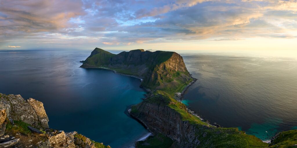
Håen, also known as Håheia, is a stunning mountain peak on the remote island of Værøy. It’s a relatively easy hike and offers one of the most beautiful views in all of Lofoten.
To get to Værøy island, you can take the free ferry from Bodø or Moskenes (passengers ride for free, but vehicles will need to be paid for). Once you get to the island, head to the Håen parking lot, the trail starting point, situated northwest of the village of Sørland and marked as ‘Håen Parkering’ on Google Maps.
The ferry schedule is a bit tricky, so plan your day trip accordingly. You’ll be leaving for Værøy in the morning and coming back late at night. The schedule is also dependent on the season, summer versus winter, and the ferry does not arrive every day. Plan ahead!
To get to the summit of Håen, you can walk almost the entire way up on a paved road or choose to walk on one of the trails on either side of the road.
5. Festvågtind
- Elevation: 541 meters (1,774 ft)
- Distance: 1.9 miles (3 km) round trip
- Time: 1.5 hours
- Difficulty: Moderate
- Starting Point: 300 meters (0.2 miles) east of Festvågtind parking lot. The beginning of the trail is about a 10-minute walk north of the village of Henningsvaer.
Festvågtind is a relatively short hike, but a steep one. It’s best to be done on a clear day to ensure you get the full 360-degree views of the archipelago and the surrounding chains of islands. The views are truly stunning and rewarding given the shortness of the hike.
The trail itself is rather rocky and can get muddy after it rains, so proper shoes are a must to make this hike safe.
6. Mannen
- Elevation: 400 meters (1,312 ft)
- Distance: 2.4 miles (4 km) round trip
- Time: 1 hour
- Difficulty: Easy
- Starting point: across the road from the Haukland parking lot
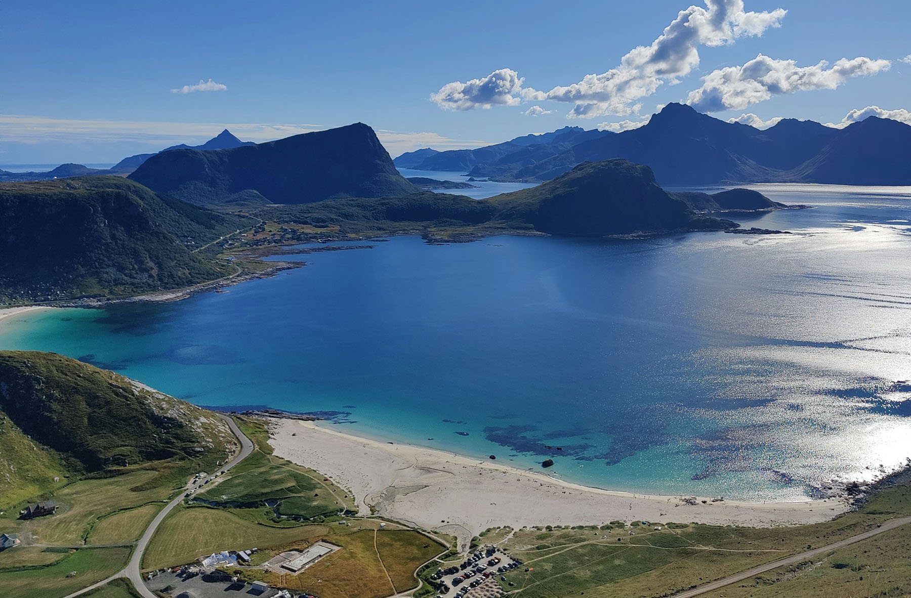
Mannen offers panoramic views of the surrounding islands and beaches, including the view of the Haukland Beach, one of Lofoten’s best beaches. It’s a short and easy hike with rewarding scenery of white sand beaches, deep blue waters and mountains in the background.
As you pass through meadows covered in wildflowers, you are likely to run into some sheep along the way. The view from the top showcases the true natural beauty of Lofoten.
7. Offersøykammen
- Elevation: 436 meters (1,430 ft)
- Distance: 1.9 miles (3 km) round trip
- Time: 1-2 hours
- Difficulty: Easy
- Description: The trail begins across the road from Lofothytter. You can park your car at the Skreda rest stop.
Offersøykammen is a relatively easy hike with striking views of the Vestvågøy island. It’s quite steep, but rather short. Sturdy footwear is recommended, especially if hiking after it’s been raining. This hike is a good option for a short adventure that offers stunning views as a reward.
These hikes vary in difficulty and time and offer some of the most beautiful landscapes in the Lofoten Islands. Have you been to Lofoten before or are you planning your first trip?